
Drumoak to Banchory

| Distance: | 7 miles / 11 km |
|---|---|
| Total ascent: | 210 feet/64 metres |
| Total descent: | 207 feet/63 metres |
| Estimated walk time: | 2 - 2.5 hours |
| Map download: | Get the PDF |
| GPS data: | Start: 57.07887, -2.34764 |
The Route
Head west out of Drumoak on the pavement beside the A93 and join the path on the left. The path follows the A93 until you reach Crathes, here the path shares the pavement for a short distance before turning left at the road junction. Cross the road at the waymarker onto the private access road. Follow the private road between the houses through a gate and across the old sand and gravel works until you arrive at a car park for the playing fields. Here walkers can cross the old stone pack bridge, cyclists and horses should follow the waymarkers to rejoin the path after the pack bridge.
A short distance further on you arrive at Milton of Crathes. Cross the car park and follow the path beside the restored railway line until you reach the outskirts of Banchory. The path runs behind the sawmill into St Ternan Park and then follow the waymarkers until you arrive at the King George V Park a short distance from the town centre.
Things to see along the way
- Park Estate – ancient hunting estate of Robert the Bruce
- Views over the River Dee
- Crathes
- Royal Deeside Railway
- Milton of Crathes Art Gallery
- Crathes Castle
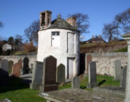
- Banchory St Ternan Cemetery with restored watchtower to guard against bodysnatchers!
- Banchory


